
Photo by Evan Semón

Audio By Carbonatix
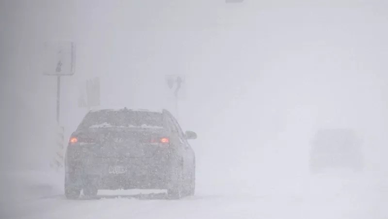
Is the apocalypse heading to Colorado? Cautionary weather maps and warnings posted by local news stations and the National Weather Service on Monday, February 16, predict upwards of 24 inches of snow in the mountains, winds at 85 miles per hour over the plains, and dangerous fire conditions in and around Denver.
“Tuesday could be a crazy weather day across Colorado,” 9News warned in a weather impact post on X. “Blinding snow squalls in the mountains, extreme winds between 60 and 85 mph, and elevated grass fire danger are the major concerns.”
That alert for today, February 17, has Colorado covered in a patchwork of warnings, including a pink fire danger warning around the Denver area, a red-and-blue blizzard warning over the mountains, and a huge swath of yellow warning of extreme wind from the southeast.
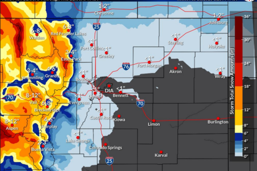
The map is based on a February 16 NWS briefing that warns of “hazardous” snowfall, “extremely critical” fire conditions and high winds across Colorado.
The NWS’s message doesn’t predict frogs falling from the sky, thankfully, but here’s a breakdown of what forecasts are warning for Denver and nearby areas.
Snow Squalls in the Mountains
From today to Thursday morning, most of the Colorado mountains will experience “a prolonged period of snowfall/blowing snow in the mountains,” according to the NWS. The snowfall will be strongest further west.
A winter storm forecast to bring fourteen to 24 inches of snow is expected over those three days in western Colorado, mostly in the northwest around Steamboat Springs. A winter weather advisory for three to twelve inches of snow will be in effect at the same time from Wyoming to Fairplay, with snowboarders and skiers happy to see areas like Breckenridge, Loveland Pass and Winter Park in the mix.
The National Weather Service
The briefing also notes “two periods of concern” when the mountains will have “heavier bursts of snowfall,” or a snow squall. The first squall will come on Tuesday morning and will affect “all mountains,” and the second will come on Wednesday evening and hit the “central mountains,” according to the NWS.
The 9News forecast also shows snow squalls hitting southern Colorado around the Sangre de Cristo mountains during those two days.
Heavy Winds and Gusts
Today, the eastern plains will see sustained westward winds blowing between thirty and forty miles per hour and gusts of upwards of 65 miles per hour, according to local forecasts. The high winds will likely last from 9 a.m. to 5 p.m. and be strongest in areas further east, including Limon, Fort Morgan and Sterling.
“Most of the eastern plains” will feel the strong winds on Tuesday, the NWS notes.
Starting tomorrow, February 18, the “windiest, driest” conditions will be across Elbert and Lincoln counties for about two days, according to the NWS, with gusts in those two counties expected to hit twenty to forty miles per hour.
Around the Sangre de Cristo mountain range, 9News is forecasting “extreme” winds at 85 miles per hour during snow squalls on Tuesday and Wednesday.
Fire Risk
Strong winds across the Front Range and parts of the eastern plains today and Wednesday will lead to a “prolonged period of critical fire weather conditions,” the NWS warns.
A red flag fire warning will be in effect today from 10 a.m. to 7 p.m. for all of the Front Range, including Boulder, Colorado Springs, Fort Collins and Denver. All of the eastern plains below 6,000 feet are also covered by the red flag warning.
The NWS warns that these areas have “critically dry fuels,” including grass and trees, and will have to deal with winds at 25 to forty miles per hour, although some gusts could register as high as 65 mph during the red flag warning.
Colorado Travel Alerts
According to a travel alert activated by the Colorado Department of Transportation on Monday, mountain snow will hit the highways, making them less safe.
In the mountains, snow and high winds are expected to “create visibility issues, drifting and difficult driving conditions” in southwest Colorado, the Aspen and Crested Butte areas, “as well as northwestern mountains including Rabbit Ears Pass,” the travel alert warns.
“Blowing snow and poor visibility” on mountain roads will last until Thursday, and trucks will need tire chains or “alternate traction devices.”
Interstate 70 will see a “lesser accumulation” of snow, according to CDOT, but “along and east of Interstate 25, high winds will create high fire danger across all of eastern Colorado.”
While it’s snowing in the mountains, “eastern Colorado will be dry, but high winds will create high fire danger,” the CDOT travel alert reads. “If power outages are required, treat dark intersections as four-way stops.”